“This is a total turnaround in the software,” said Bass. “We are able to do an entire tree inventory for golf courses and as part of a package we can determine shade on tees, fairways and greens. With our models we can do any tree based on any time of day and length of time.
“As a side benefit,” Bass continued, “we use GIS (Geographic Information Systems) to do irrigation mapping, calculate chemical applications and manage inventory. We are trying to be more comprehensive in what we are offering superintendents so they don’t have to buy 10 other programs.”
The process of layering GPS maps with GIS information begins with Point DataMap that the firm creates during the tree inventory process.
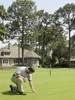
“Trees need to be managed as a whole not site by site, especially if they want trees removed,” said Bass. “Tree removal is an emotional issue. We are doing inventories now because courses have matured so much and have overgrown trees. Trees are competing with one another and turf issues are coming up because of shade and they need help to get them removed.”
Bass recently began the three to four week inventory process at Interlachen Country Club in Edina.
“Apparently Hale Irwin played there last year and said they could get rid of half their trees and no one would notice. That was the wake up call to get an outside evaluation,” Bass said.
Interlachen CC superintendent Matt Rostal said they brought Bass in because trees were starting to cause problems on the course.
“This is a very useful tool,” said Rostal. “We have 2,100 trees on the course and we are getting a full master plan that will include a pruning, trimming and tree removal program.
“We could take down as many as 500 to 700 trees over a three to five year removal plan,” Rostal continued. “We have trees that are crowding each other, are diseased, are stealing water from turf and creating shade issues. This plan will give us a tool to sell tree removal to our membership.”
According to Bass, members are usually blown away by the results.
“We evaluate every tree, identify problem areas and build a management program for the next 10 to 15 years. This sets a course on a firm pattern,” said Bass. “Once they figure out the value of their trees, they know they need to do more than spend $5,000 a year on pruning. We give the superintendent the hard numbers and information they need to get their job done.”
After the tree inventory is done, the firm can add GIS layers that pinpoint and quantify exact areas to create accurate spray programs and reports. This information can be used to manage inventory and develop a course maintenance history.
“GPS maps are only half the story,” Bass said. “GIS lets you analyze information.”
Explore the July 2003 Issue
Check out more from this issue and find your next story to read.
Latest from Golf Course Industry
- From the publisher’s pen: Foggy intrigue
- USGA releases Water Conservation Playbook
- Vilamoura Golf courses awarded GEO Certified status
- GCSAA’s Health in Action 5K/2K reaches fundraising goal
- Landscapes Golf Management to participate in data analyzation initiative
- Reel Turf Techs: Carl Michael
- Atlanta Athletic Club approves funding for master plan
- Maximizing Cultural Practices and Agronomic Benefits with Minimal Surface Disruption